
Summary
June 1st
Stealth Camp to West Mountain Shelter
NOBO mile# 1396.8
Tolmann’s daily mileage 15.1
Tolmann’s total mileage 373.1
Got another weather alert last night showing that I was in the path of a thunderstorm cell. It was pretty clear this one wouldn’t miss. I lay dozing, waiting to see what would happen. Before long, I heard thunder in the distance, then growing closer. What I was most concerned about was the winds, which were potentially strong with 50 mph gusts, and the potential for hail, which can punch holes in tarps. My camp was slightly down and behind a rise, and the ground I had hung over actually was a bump, so I wasn’t worried about water pooling under my gear, at least.
Then the wind started to rise, and I heard the first drops of rain. The windward side of the tarp bowed in like a sail, and the trailing side began to flap wildly. I unzipped the bug netting on both sides, reached out and grabbed a fistful of tarp on each side. The worst case scenario was the stakes being pulled free, and even being launched like missiles, which could cause some damage. So I held on tight. I was also concerned that there might be lightning strikes, but the thunder stayed relatively distant.
After about twenty minutes of hanging on, it was clear that the tarp was gonna hang in there, so I let go and zipped back up. There didn’t seem to be any wind blown water of consequence coming in the ends or under the tarp, so I just relaxed, and enjoyed the feeling of being snug and dry amidst the storm, and fell asleep.

 When I woke up, I knew I had a challenging day ahead. As far as I knew, the PUDs of the day before would continue, and I really wasn’t feeling up to the challenge. But I packed, ate breakfast and saddled back up. It was only a quarter-mile down to the road, and I was thrilled to see a water cache there, as there had been at the previous road. Then I crossed the road and began one of the most frustrating and painful ascents and descents of the trail thus far. There were many places I had to use my hands to pull me up; I was really pissed off. I’d get to a level spot, only to find yet another scramble ahead. And then, crossing the top of the hill, I’d have to push through the trees and bushes, their leaves fully charged with the rain from last night. There’s nothing quite like being slapped in the face with wet leaves, especially when you are angry to start…
And then, the precarious, wet, treacherous climb down, again forcing me many times to use my hands, feet slipping just enough to keep my heart racing. The only good thing about it was that the grade was so steep, I lost altitude relatively quickly. That said, though, I think I was making less than a mile an hour for that entire stretch. At that rate, my 11+ mile goal to get me to the next shelter was not going to go well. 

I was feeling pretty low at this point. It was a bit of a road walk to get to Harriman State Park; walking up the road, I was feeling like I really wasn’t up to the challenges of today, and if all of NY was like this, the challenges of NY.
When I got to the park I found a place to take my pack off, dealt with some hygiene issues, then sat down and reflected.
One thing about hiking the Appalachian Trail, one really doesn’t have too many choices. Either walk or you don’t walk. There really was no other way forward except to walk.
So I walked. The climb up into Harriman State Park is only relatively easy compared to the other climbs I’ve done so far. It still meant forcing myself up carrying that heavy pack. The slope went up and up and up; but did lead to a very parklike area on the top; really quite stunning.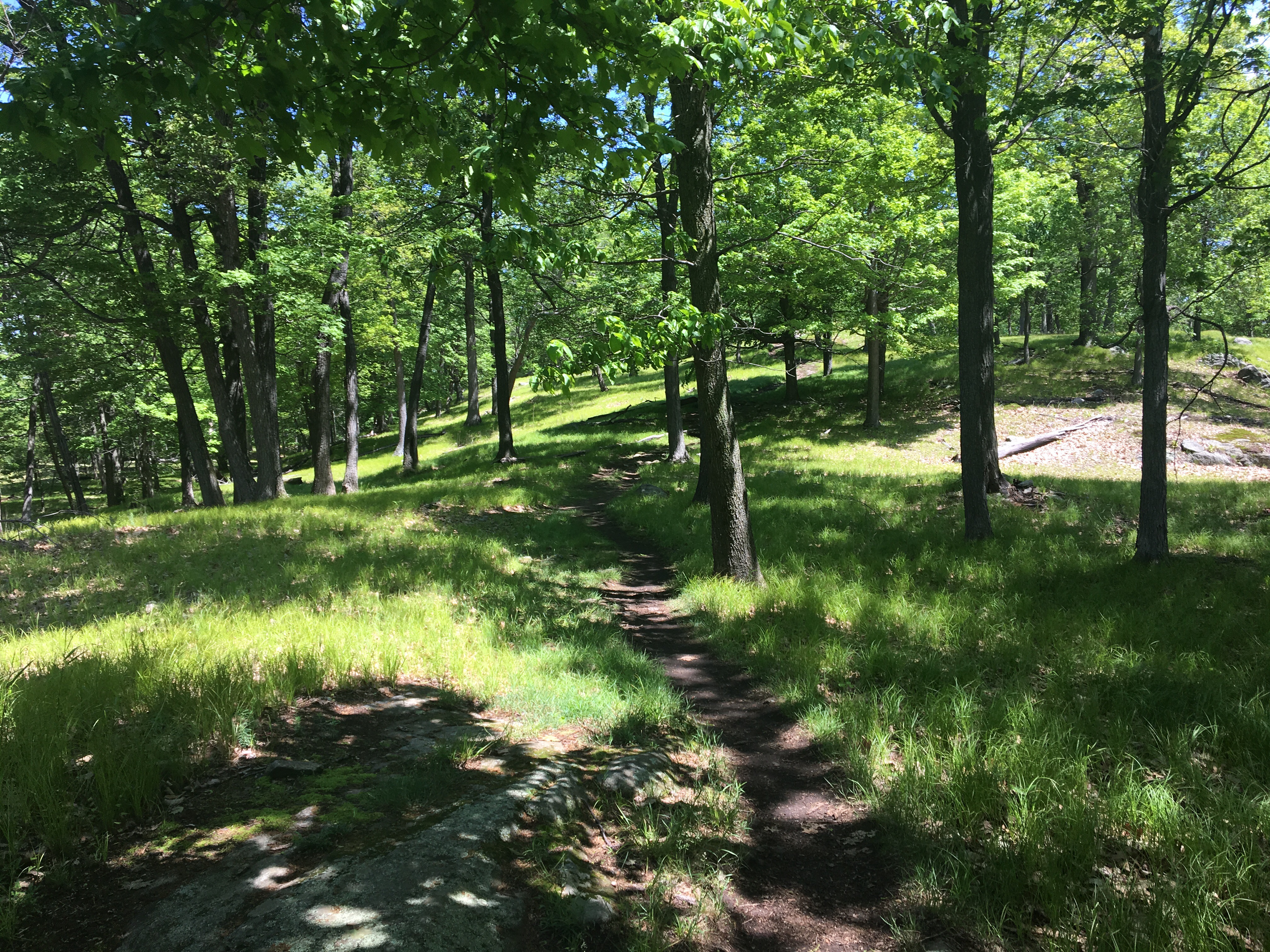
I knew that Tilly And Hops had camped about 3 1/2 miles ahead of me; I was finally getting to that section. But morning was passing, and I was getting anxious.
That’s when I came to the infamous Lemon Squeezer! I remembered seeing pictures of the Lemon Squeezer online. As I climbed into the cave at the beginning, I realized I was in trouble. There was no way that I and my pack would go through together.
 I dismounted, and began taking things apart. A couple of items at a time, I carried them up and through, and placed them on the ledge. When I started to take the side bags off, which was a more involved process, I paused. Maybe there was a bypass trail so I wouldn’t have to try to carry my pack through. So leaving my stuff there I went back out of the cave and started looking around for another way.
After a not very exhaustive search, I thought I only had the one choice: to go through.
So I continued to take my pack apart, and carry as much as I could handle at a time up and onto the ledge. Then I had to reassemble my pack. I think this all had to take me at least 40 minutes. I was very frustrated. My schedule for the day seemed shot.
Once I put the pack back on and started climbing again I realized I was not out of fire yet. The guidebook said there were some areas where I would need to use hands to climb up. By this time, I was pretty much done with this section, at least emotionally.
Then I noticed that there was a blue bypass trail, sort of ironically called the “easy way”. It was pretty easy to make that decision, but the easy way is not always easy. In this case, a downed tree made it impossible to follow the blue blazes up, and I had to break my own trail to make my way around it. Finally, I stood at the top. Which, of course, really wasn’t the top. But it led to more of the park-like walking, eventually.
After that I started to make some good time; and I began to think that I would be okay. The shelter that I would come to next, Fingerboard Shelter, has been seeing a lot of bear activity. Bears have been known to take food bags, and even backpacks, and there are posted warnings about bears online. We’ve heard first-hand accounts of some of this from hikers going through before us.
This is where I stopped for lunch.
There were four other hikers already at the shelter, having snacks and lunch, and sitting out a brief rain storm that blew in around 1 o’clock. I sat down and pulled out my lunch, and then the rain started again. I had a good chat with the hikers, three of which were going southbound, and one going north.
The rain let up, but still I put my pack cover on to continue hiking towards William Brien Shelter. I didn’t see any bears.
Based on my pace to that point, I was pretty sure that I could get to the next shelter by 4:30 PM. So I started hiking hard, thinking that my day would end there.
My guesstimate about how long it would take was right on; it was just about 4:30 when the shelter came in sight. It was empty.
I had a feeling that Hops and Tilly might have decided to go to the next shelter if they got to this one early enough. I checked the shelter log, and sure enough, there was an entry saying as much. I was disappointed. I was frustrated. And yeah, I was angry. But most of that anger was directed at myself.
I keep telling myself that this hike, this journey is mine, that I have to be careful of placing too much emphasis on the friendships I’m building, that I have to do this on my own. Trail families come and go. So I have to learn how to be comfortable by myself; that may be the biggest learning of all.
And still, I felt compelled to keep going, to go the additional 3+ miles even though I was tired, and I wasn’t sure that I had it in me.
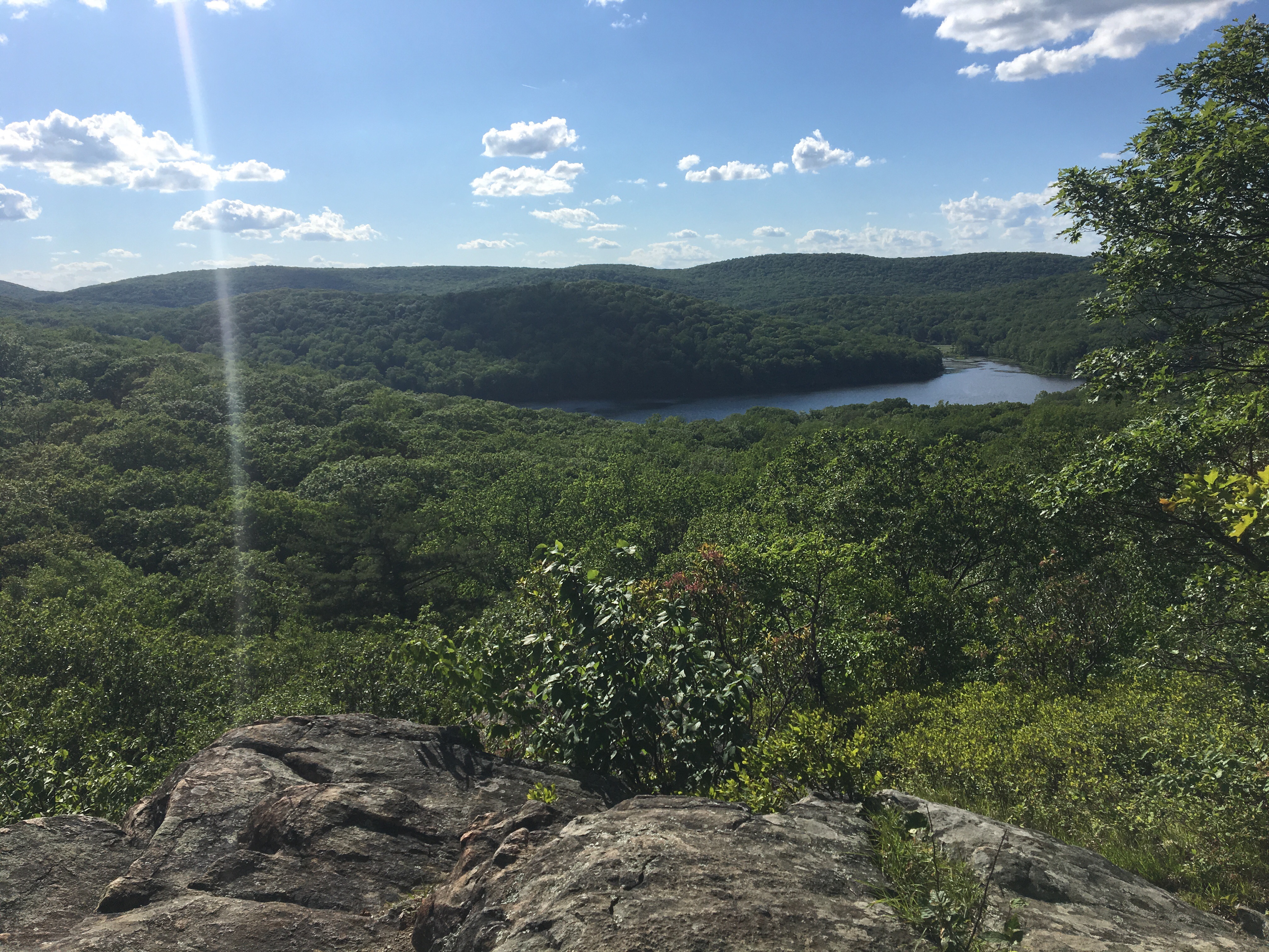
There were two more significant climbs between William Brien Shelter and West Mountain Shelter. There also wasn’t any water available at West Mountain. But West Mountain Shelter was supposed to have an incredible view of the Hudson river, and even a view of Manhattan skyline, and it would set us up for a shorter hike tomorrow to Bear Mountain and Fort Montgomery, so it really would be a win to get there.
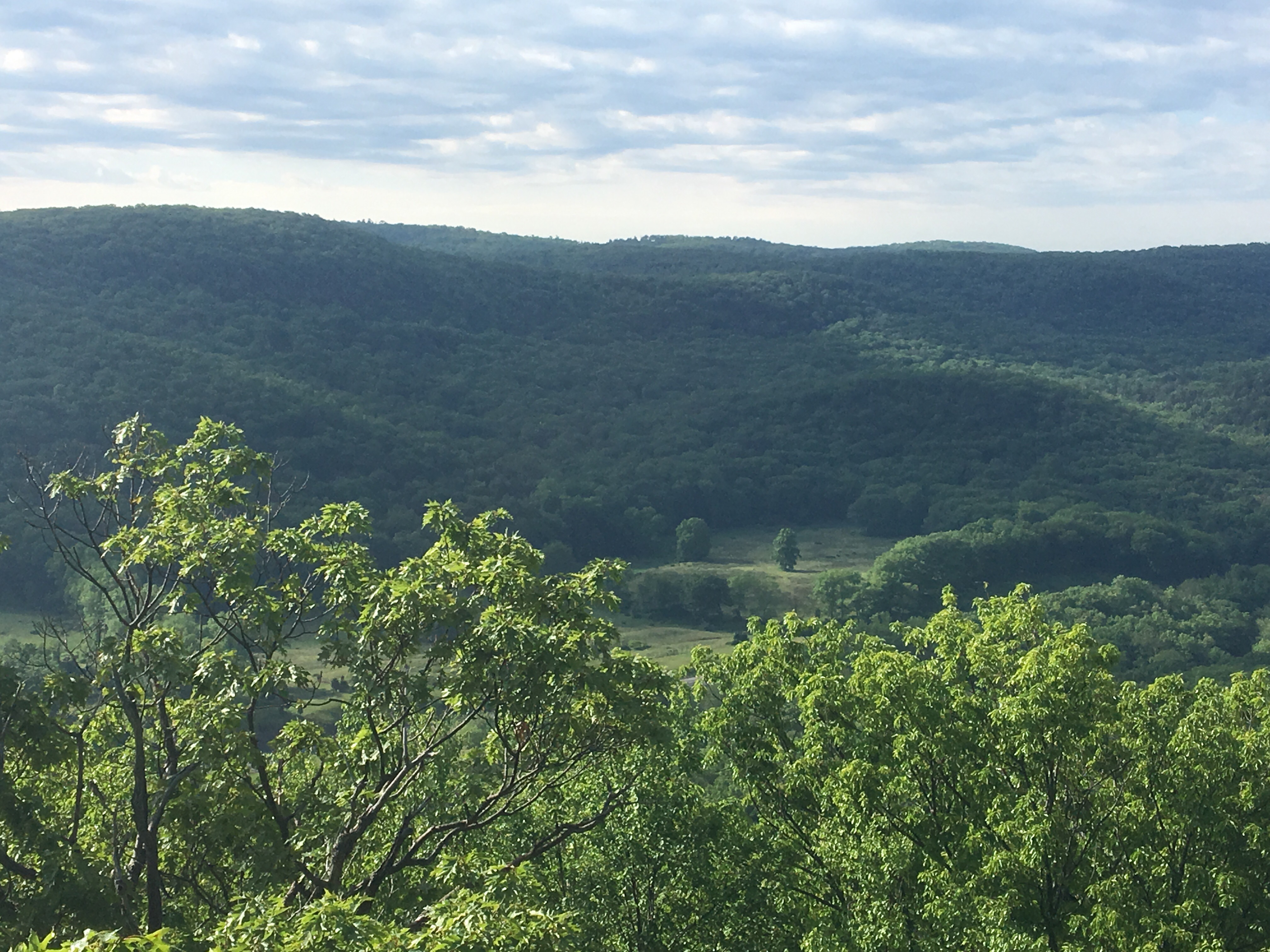
First, there was Black Mountain. After a grueling climb, the views from Black Mountain were spectacular. 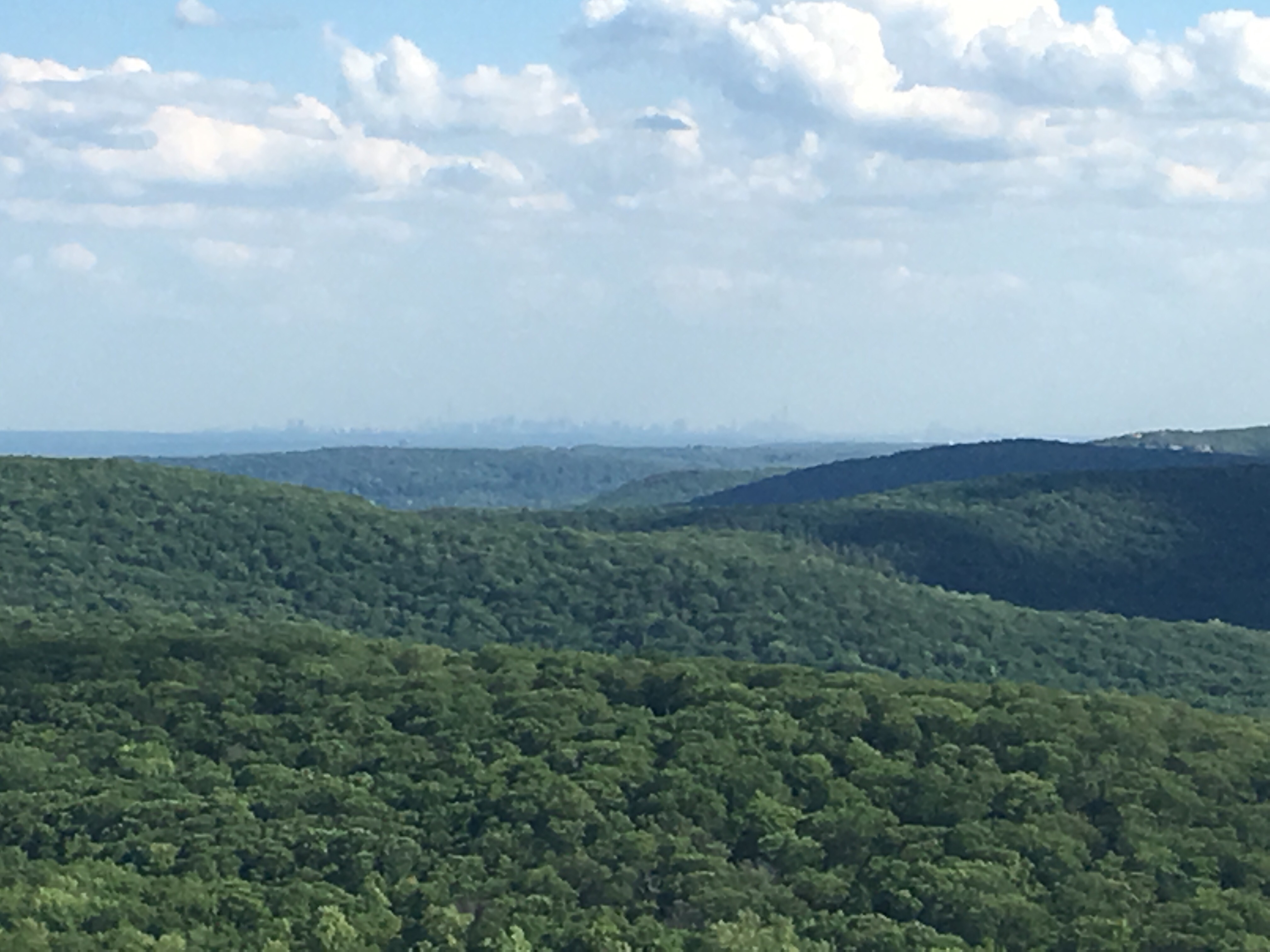
 Even in my depleted state, I could appreciate that. They were at least a preview, if not even superior to, the views we would have on West Mountain. But I had to come down from there and the trail was not easy, though nowhere near as difficult as some others.

But there at the bottom, was another obstacle: The Palisades Interstate Parkway at 5:30 in the afternoon. Rush hour.
Unlike other road crossings, there was no bridge, there was no tunnel; you had to walk, or better yet, run, to get across! This is where I feared I would be spending the night, on the median between the two directions. It was probably only 10 minutes, but it felt much longer, waiting for a space to run across.
And then my way was cleared to get to West Mountain shelter; oh, wait, there was still the climb. And I needed to fill up on water since that was none at the top.
In case I haven’t mentioned this before, 1 L of water weighs 2.2 pounds. I would need to carry at least 3 L, so that is about 7 pounds. One can really feel the effect of adding 7 pounds to one’s pack.
At the top of West Mountain, there’s a side trail that leads to the shelter. It is about half a mile long, and at the end of a long day, a half a mile seems twice that. I was spent. But at the end, I saw Tilly And Hops’ familiar blue tent and was ready to put my pack down for the day. Two trees were all I needed, and a little supper.
The view was all it was promised to be. 
 And it felt wonderful to be reunited. Tomorrow, Bear Mountain, then Fort Montgomery. New trekking poles and BBQ. Shower and laundry. Bed.

Leave a reply to Tolmann Cancel reply