
Summary:
May 3rd
Raven Rock to Antietam Shelter
NOBO mile 1071.7
Today’s miles 12
Tom’s total miles 48.0
 Today’s goal, if there was one, was to put in 10 miles to get to the Deer Lick shelter. This would put me in position to do another 10 miler to Rocky Mountain shelter, which then would stage me for my first ‘nero’ day: 4 miles to Fayetteville, PA, and the Trail of Hope Hostel. Funny to think of 4 miles as a ‘near zero’ (nero) day, since a few of my days have been 4-5 miles total!
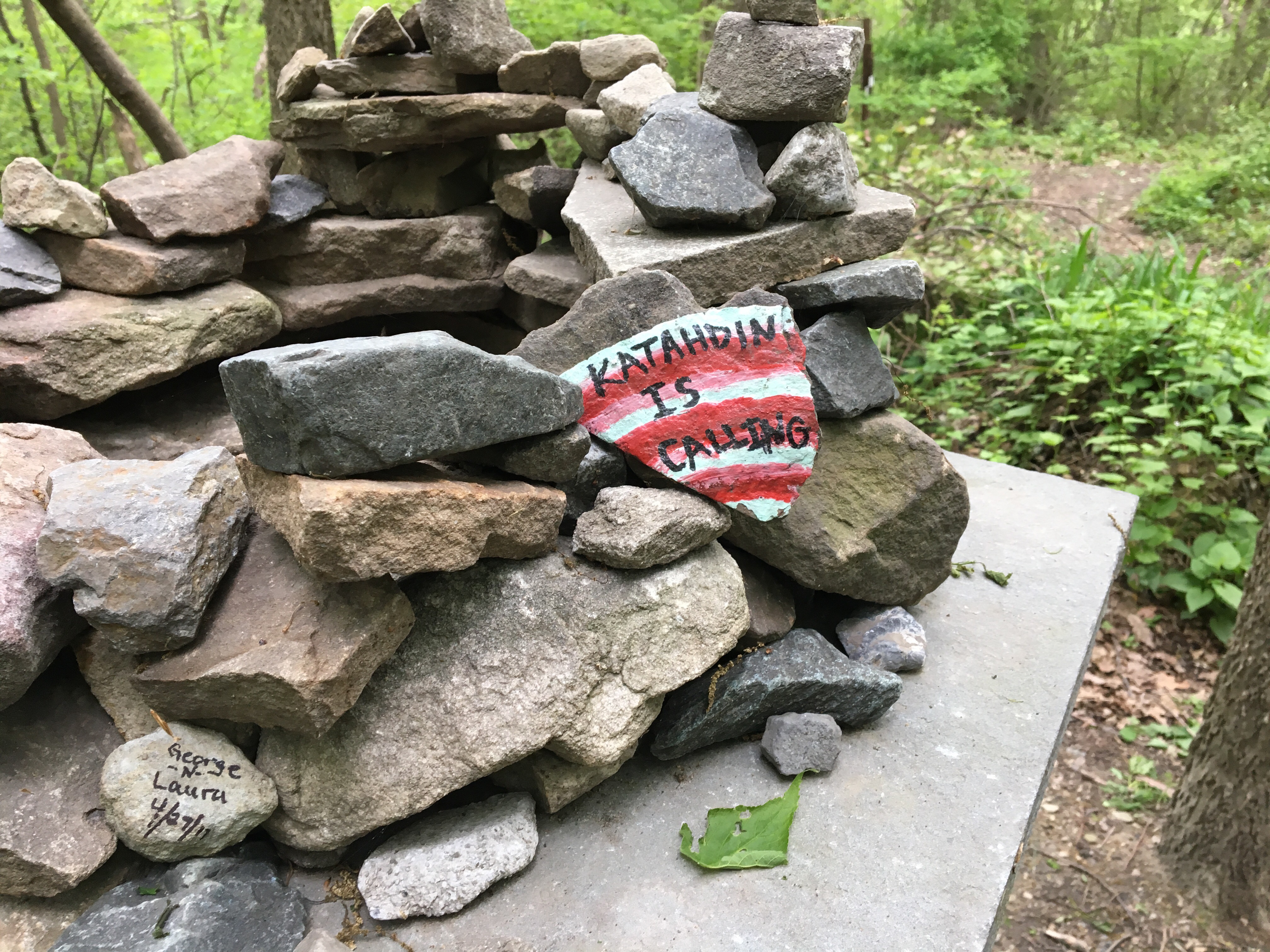
Today had another milestone besides the planned 10 mile record breaker (for me): I was leaving Maryland and entering Pennsylvania (via the trail, since I’d already shuttled into PA for my shin splint zeroes).
The 5 miles from Raven Rock to the Mason-Dixon Line took me down off the ridge, where the shelter was, on a very steep, rocky and uneven path. Just before the descent was a .2 mile blue blaze loop to something called ‘High Rock Overlook’. In all the reading I’ve done a primary regret is not taking in the blue blaze overlooks. No regrets for me!!
Apparently it’s a very well frequented place and accessible by road. The place was completely covered in graffiti of rainbow hues; it was pretty striking visually; however unfortunate (actually criminal) the defacing of the natural setting was.
A sign there said this was a place for launching hang gliders.  The view was stunning!

As I said, the trail just plunged on down after that, and I had to move very slowly and methodically. It was disappointing to me how I couldn’t make any time, but there you go; that’s my ragged edge, right out there waiting to be smoothed down…
When the trail leveled out (that’s a relative term), it still scrambled over rocks and I got myself off trail a few times, having to bring my attention away from my feet and back to the blazes.
At one point I heard something moving to left of the trail; out bounded a beautiful white tailed deer across the trail and to the right of me. She stopped sort of with her back to me but looking intently at me at the same time. Her tail had gorgeous markings. Then I noticed a younger deer (perhaps her fawn) off to the left. They stood watching as I slowly moved on. I’m sure deer will be a common sight along the trail, but this first look was magical…
It wasn’t long after that I reached Pen-Mar County Park. This was one of the first amusement parks back before automobiles; built by the railroad. They closed it down when attendance waned when cars, radio, and air conditioning made it a less desirable form of entertainment. As I went through today, it’s clear that it’s regained some measure of popularity; the staff was preparing for the yearly opening weekend come up on Saturday. 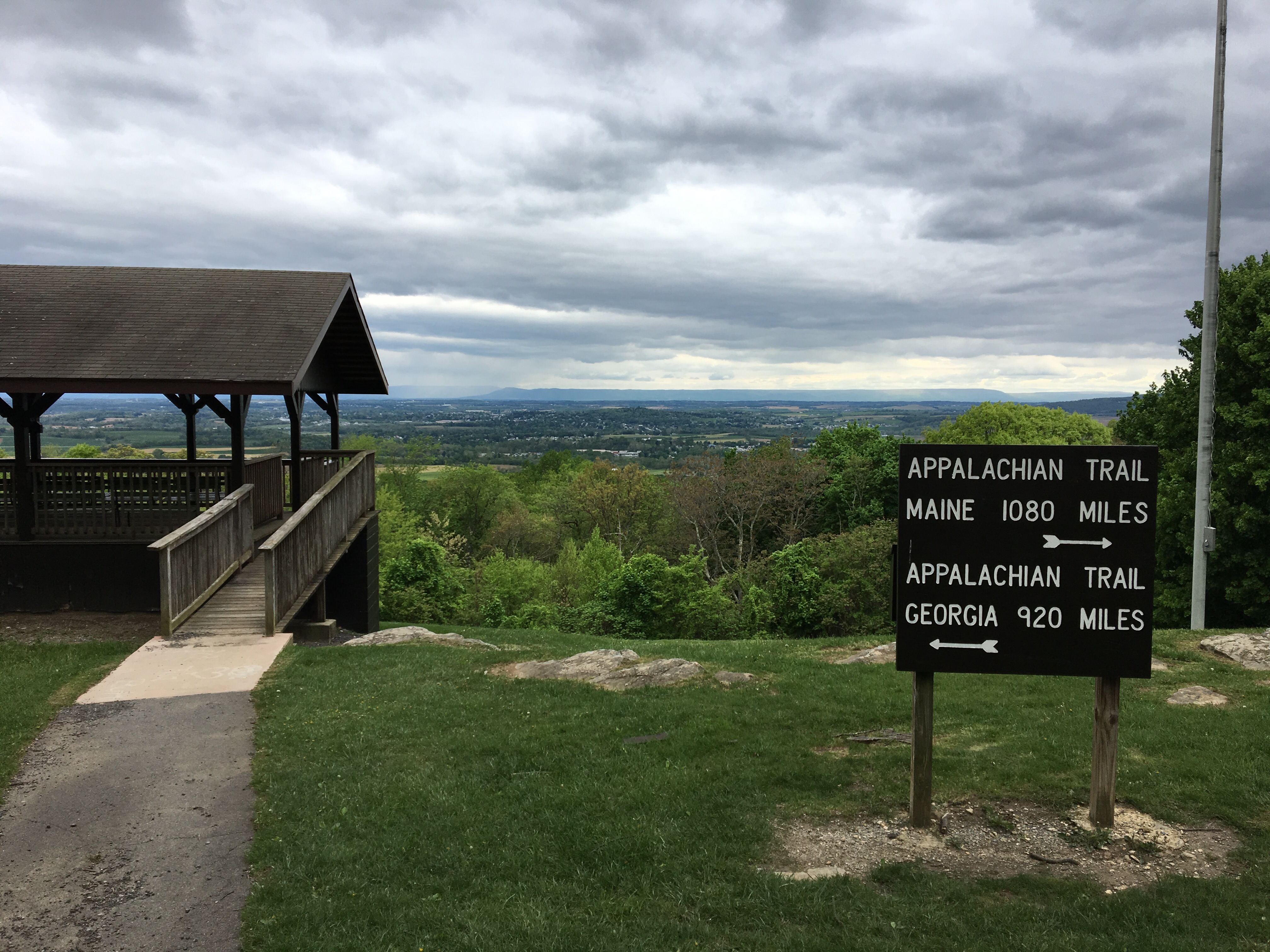 Rain in the distance
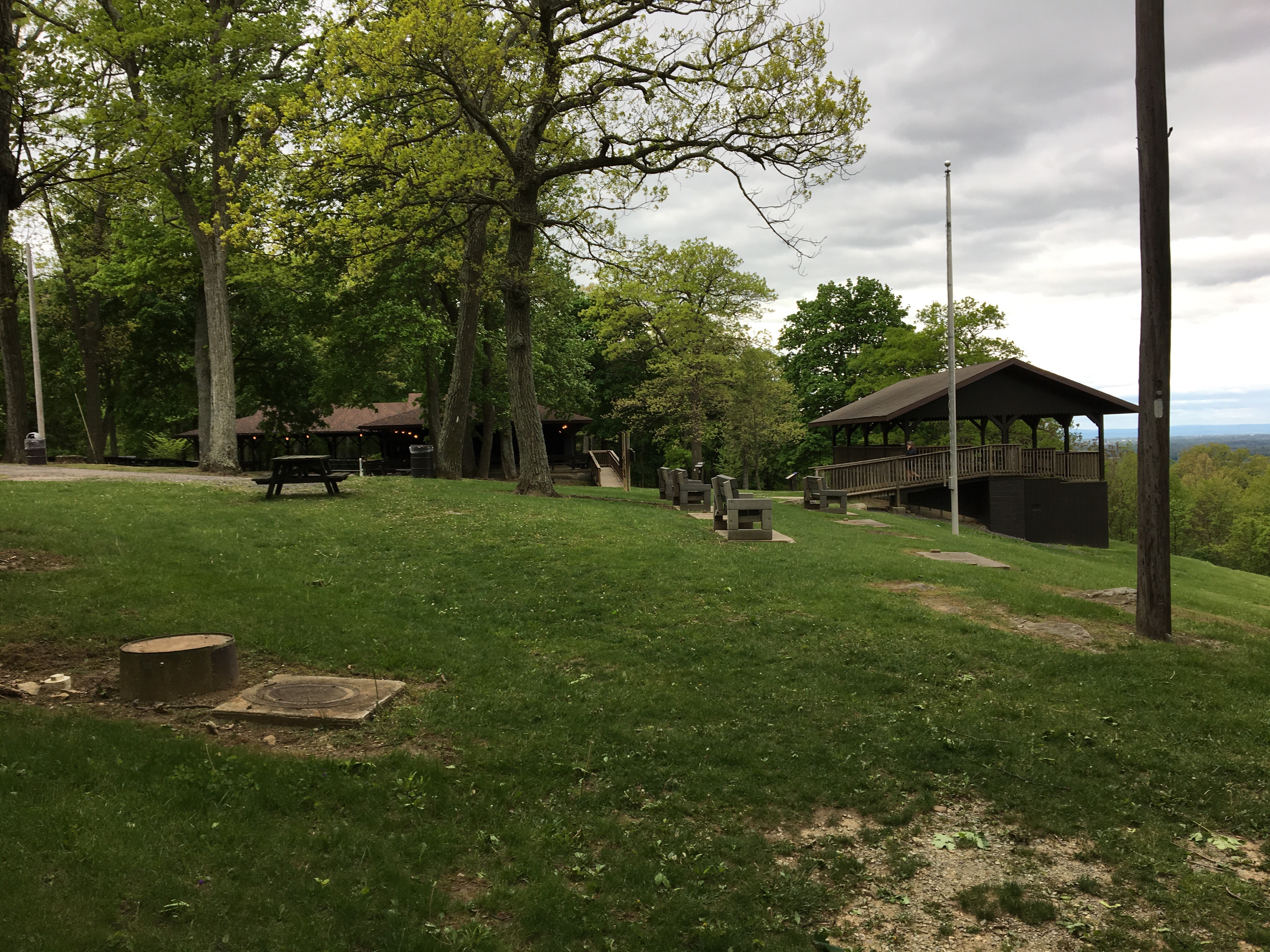
When I got there, there was a chilling wind blowing, making it hard to sit and observe the doings for any length of time. There was a young girl there putting on extra layers before she backpacked off. I imitated her, even though I hate hiking with my raincoat. It paid of because I was beginning to shiver, and I immediately felt better.
The path out of Pen Mar led to a railroad track (not surprising given the history) and I lost the trail yet again. Using a AT-based iPhone app called Guthook’ s Guide got me on the straight and narrow again in no time. That’s when the path took me across the Mason- Dixon Line. 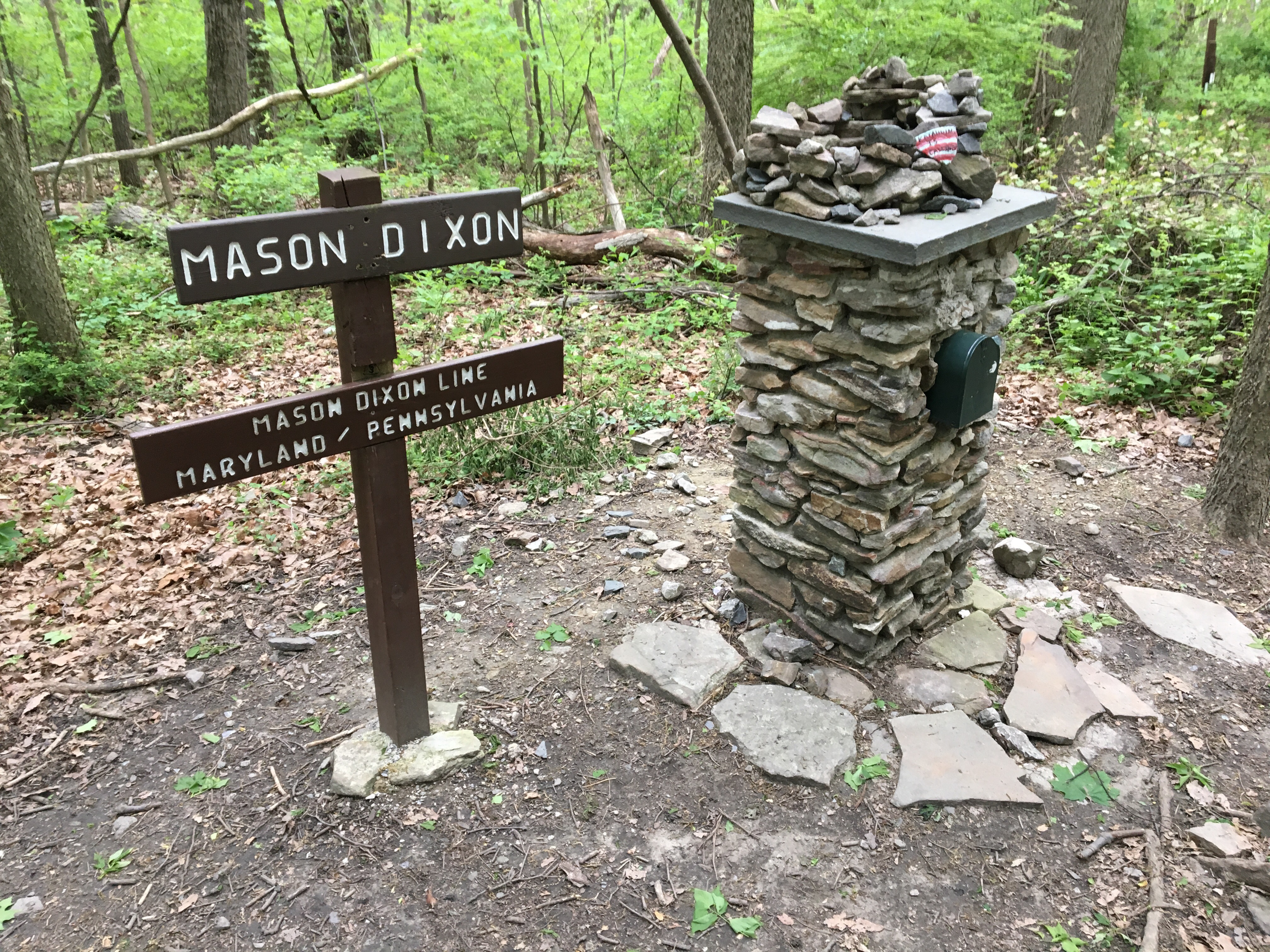
Woo-hoo! Entering my 3rd state!!
Now I have a confession to make: one of my edges, one of the strategies I use for not staying present, is to get into drive-mode. Drive-mode has no space for stopping for adjustments to gear, no space for stopping for lunch, no space for stopping, period. I make excuses: “oh, there’s nowhere dry to sit down”, “I’ll just go a little further…”, etc., etc.
It’s the other end of the range of comfort in Nature that I aspire to…
Yeah, that’s where I ended up after crossing into Pennsylvania. I caught myself after I realized I had passed multiple opportunities to collect water. So I stopped. Got water. Breathed. Then mounted up for another stretch where I DID IT AGAIN! I was saved this time by the trail coming to a picnic table sitting on the side of a road, right next to a pretty burbling stream. 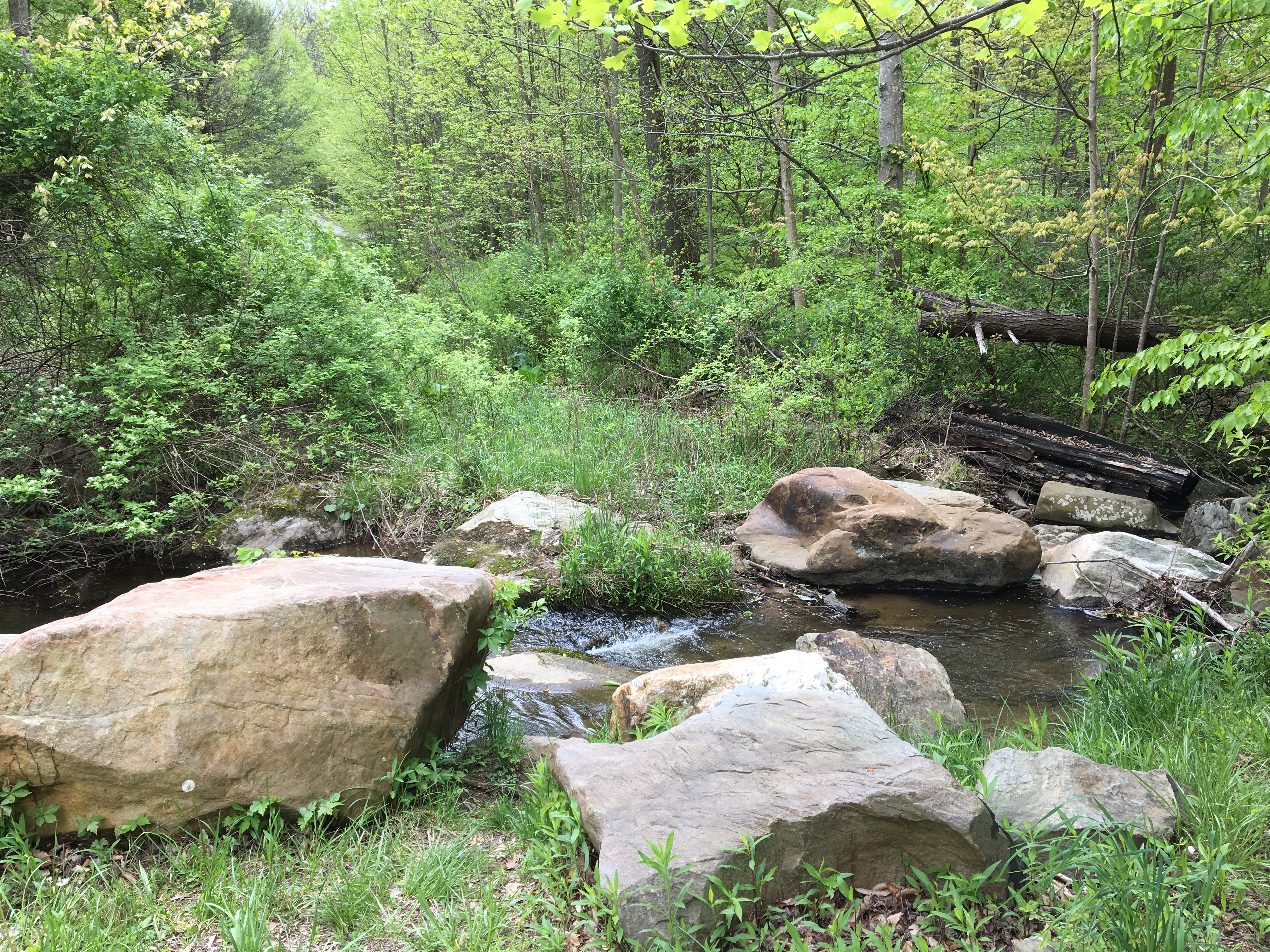 Pretty burbling stream
So I stopped. Made lunch. And just let it be ok to be not moving. And it actually was better than ok! The sun was shining down and the air felt warm for a few minutes.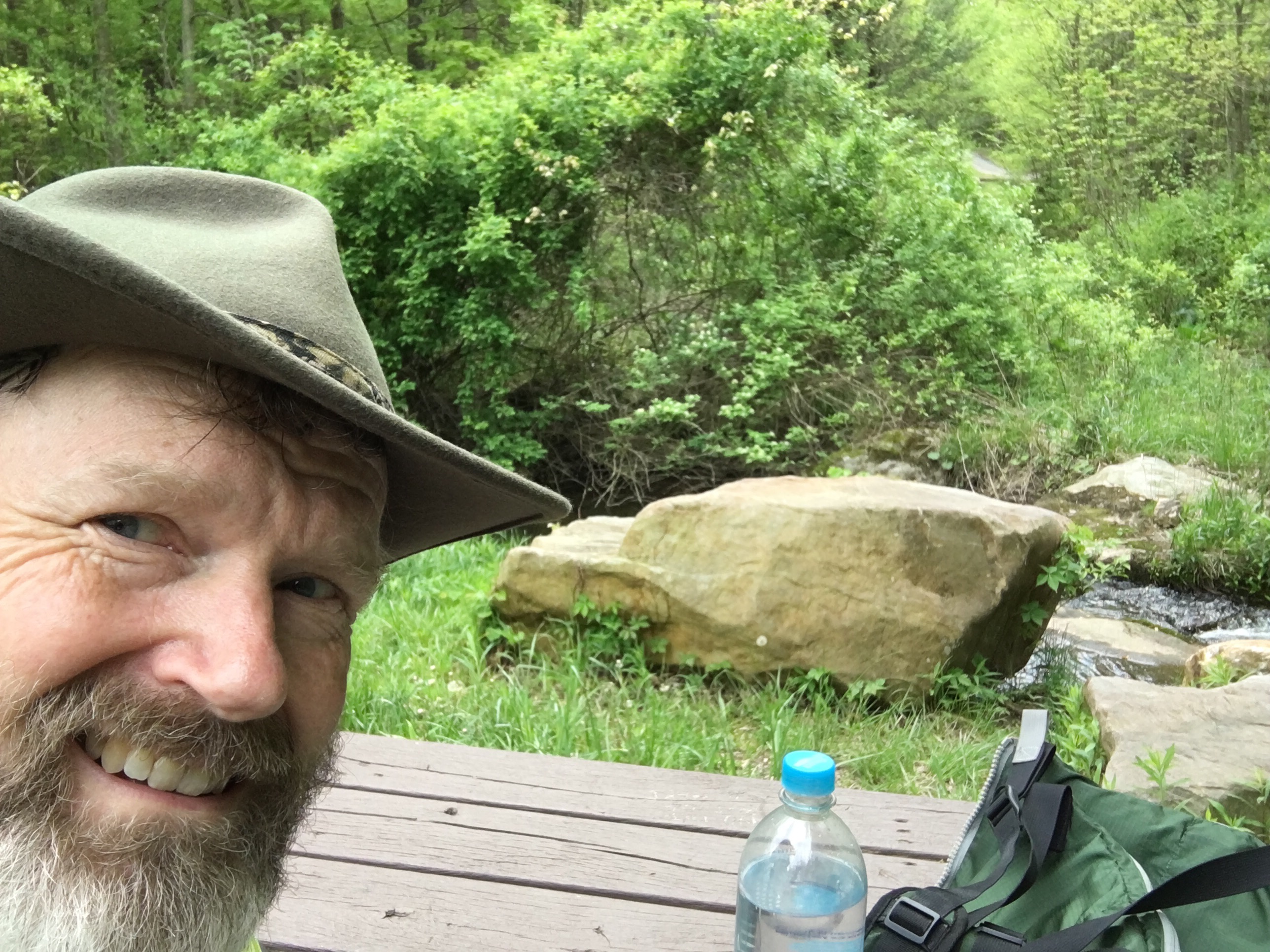 Me and the pretty burbling stream
I did have to get moving again, but the Deer Lick Shelter was only a few more miles, and it was only maybe 1 o’clock-ish… “Hey”, I thought. “The next shelter is only a few miles after that. Maybe I could get there. Hey, and Scotty (trail buddy I met last night at Raven Rock) said he was trying for Tumbling Run shelter, that’s only another 2-3 miles beyond. Maybe I could get there!”
And so, off I ran, with visions in my head of an ACHIEVEMENT!
But, as I walked, I knew I was getting myself in over my head. I eventually talked myself in off the ledge.
Until I got to Deer Lick shelter. It was only 2:30pm. There was no one else there. The camp sites were iffy. The best hammocking site was right on the edge of the trail. And Antietam Shelter was only 2.6 miles further along.
Packed back up, hit the trail.
So here I am at Antietam shelter. Actually, I’m hammocking some distance away, next to a stream. 
The shelter area is like something out of the old computer game, Myst. A branching stream (Antietam Creek), with bridges going every which way connecting islands and eventually leading to the shelter. 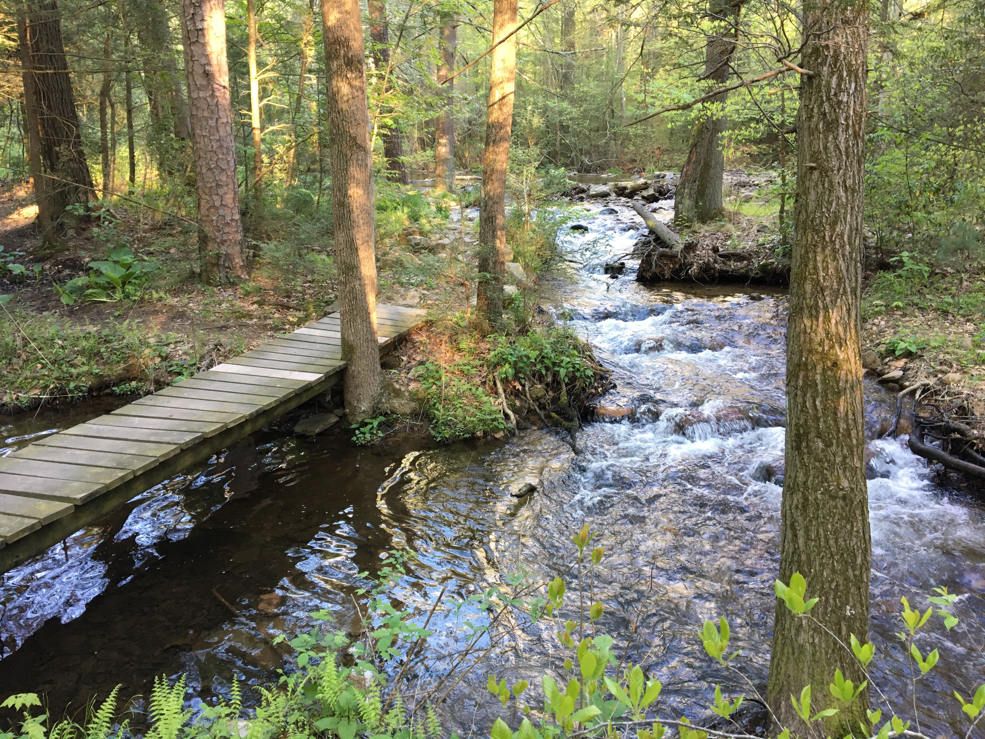

 The shelter is just visible through the trees to the left in the image above.
It’s a very lively spot, and, although I’ve been alone here a good while, a group has set up across the stream, and lit a fire. Since the shelter is near a road, I don’t if they are locals partying or backpackers camping for the night. But the stream is energetic and a perfect, natural source of white noise.
12 miles today; a personal record. God give me strength to stay away from records in the days to come! 😉

Leave a reply to Nancy Beaudette Cancel reply