
Mt Washington to Nauman Tentsite
August 14th-16th
+AT mileage: 5
Total trip mileage: 12
After completing Webster Cliffs, I wanted to get another significant piece of the Presidential Traverse done, so I figured that I’d go south from Mt Washington back to Mt Pierce, doing it as a two nighter with stays at Lake of the Clouds AMC hut and again at Nauman Tentsite at Mitspah Springs.
I started with another overnight at the AMC Highland Center, with a shuttle to the Ammonoosuc Ravine Trailhead parking lot. The Jewell Trail begins across the street from the parking lot, and goes up to the left and parallel to the cog railway. Again, I was starting with a stamina deficit, but I had all day to do the 6 miles to the Lake of the Clouds hut, for which I had a reservation the first night. The day was bright and fairly cloudless, and by midday, I was up above tree line with the talus field laid out before me.


I sat on a boulder to eat my lunch (and catch my breath) and look out over Ammonoosuc Ravine and the cog railway. Across the way and above, the Lake of the Clouds hut was already visible, and remained so throughout the day. I knew my best strategy would be to just put one foot in front of the other, and not judge my rate of progress, and, for the most part, was successful. Sitting looking up, I could see the trail coming from the northern summits where the Jewell Trail conjoined. I didn’t think it would take 3 hours to get there, but it didn’t take long for me to reset my expectations. The ascent through the rock jumble switchbacked over and over, and, as always, required the occasional scramble. The path along the ridge line above slowly drew nearer, and by the time I got there had taken a lot of the fight out of me.
They say the Jewell trail is the easiest ascent of Mt Washington, probably because it starts at a higher elevation, and rate of ascent is more gradual. That said, there is no easy way up Mt Washington.
 When I reached the Gulfside Trail along the ridge line, I was now officially on the AT. It then ascends to the summit of Washington, and, merging with Crawford Path, descends to Lake of the Clouds. There is also a “blue blaze” trail around the summit called the Westside Trail that circumvents the summit and a little more than 1 mile of the AT to intersect with the Crawford Path further south. By the time I reached the Westside Trail cutoff, I was beginning to be concerned about getting to the hut late, which would reduce my choice of bunk, and could effect whether I got dinner. So I chose to take the path around.


Up to this point, I was finding the trail to be a very social experience. Once I was above treelike, there was a steady stream of hikers around, and a few that I paced for a while. However, Westside Trail was deserted except for me; I picture a close up of me with a pull-away into a helicopter shot, me wandering amongst boulders until I’m dwarfed by the mountain.
Upon reaching Crawford Path, the stream of hikers began again. I met a trio of women coming down off the summit, and we leapfrogged the rest of the way to the hut. The hut itself was pretty crowded already when I arrived, but I got a bottom bunk and was able to change into dry clothes before finding a seat in the common area to watch the sun go down.


As I’ve said, the meals in the huts are not gourmet, but homey and plentiful. I found myself amongst gregarious, lovely folks and we talked of our day’s travels, and about the hiking adventures we’d been on. I found folks were very interested in my thru-hike attempt, so there was nice back and forth to it all.
 We also had a few thru-hikers who were doing work-for-stay; it felt a bit surreal to be a paying guest, seeing the thru-hikers as an observer.
Sleeping in the bunk rooms of the huts is not easy. I think the max occupancy of Lake of the Clouds Hut is around 90 people, and we had nearly that number. Lots of shifting around and the ever-present choir of snorers. But eventually the light brightened in the skies, and folks started moving about as a new day began.


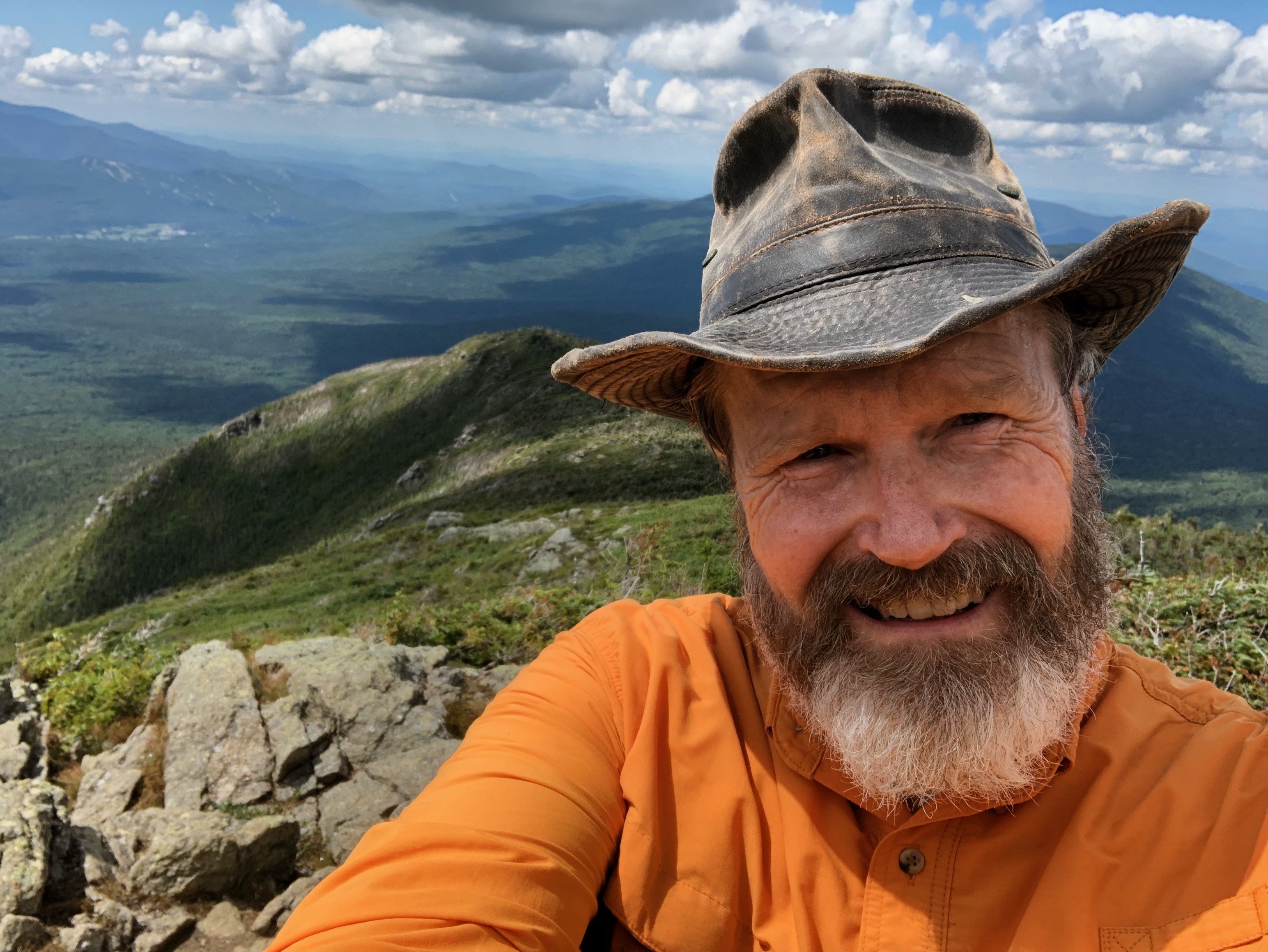
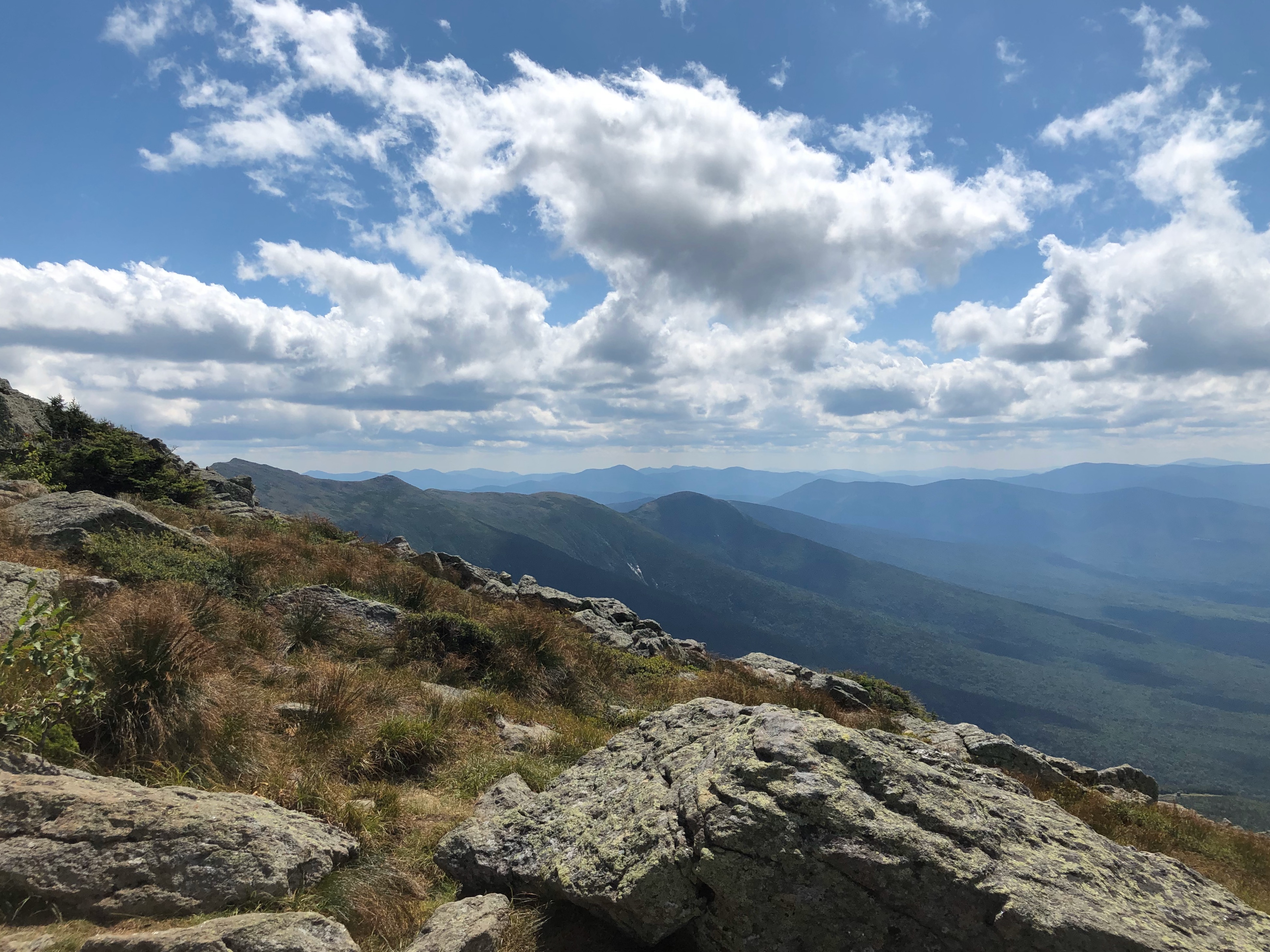
I must admit that this day was probably one of my top 10 days on the trail. It was a really moderate hike from Lake of the Clouds to Mitspah Springs, and the weather was pristine. One hiker I encountered during the day complained that it was too sunny; I could not agree. The trail trends moderately down all the way, with a few minor ascents. views were totally unobstructed, since one is above tree-line for 80% of the time.


I was able to saunter most of the way, taking breaks often, sitting and enjoying a snack and the incredible vistas. Had I desired, I could have checked two additional 4k footer summits off my list (although I’m really not shooting to complete that list): Eisenhower and Monroe. But I came out to walk the AT, and those summits are blue-blaze trails.
The last summit of the day was Mt. Pearce, after which there is a precipitous, though short, drop into the saddle between Pearce and Mt Jackson, with Mitspah Springs tucked into the shoulder of the mountain. Just above the AMC hut there is a set of boardwalk/catwalks cantilevered on the side of the slope that look pretty sketchy, but seemed solid enough when I walked over them.
 It was probably mid afternoon when I arrived at the tent site, picked out my hang spot with the help of the caretaker, and set up. Last time I was there, I had to live with the black flies swarming about. I also had come into camp utterly spent, with the only goal in mind to climb into my hammock and disappear. This day, I was tired but not too tired, the bugs were reasonable, and I was able to approach setting up camp and preparing dinner in a relaxed, spacious way. Again, this was a highlight amongst my AT memories. The caretaker was the same gentleman that was here when I hiked Webster cliffs, and he recognized me, so we had somethings to catch up on.
As the day started to fade into dusk, there were two other hammockers (I believe they might have been thru-hikers) that set up camp nearby. I had already crawled into my hammock, so I never got to talk to them.
The next day, I got up after my hammock neighbors had packed up and left. I packed myself up, and went over to make up some coffee and breakfast on the wall outside the hut, again taking my time and luxuriating in the space. Then it was down the 2.3 miles to the Highland Center to the car.
I’ve made a little bit of a difficult situation for finishing out the Presidentials. One option is to take the cog railway to the summit of Washington, then take the Gulfside Trail north to Adams and Madison. Or I could go back to Pinkham Notch and try the circuit I originally planned taking the AT south to Washington and go back through Tuckerman’s Ravine to my car. The second option may require more conditioning than I currently have.
In any case, over the past couple of trips I’ve added almost 10 more miles, bringing my total AT mileage up to ~830 miles.

Leave a comment