
Summary
NOBO mile# 1668.3
Tolmann’s daily miles 12.1
Tolmann’s total mileage 644.6
Made the mistake of typing up this day’s blog on my iPad, but not finishing it. So I don’t have access to that on my iPhone. <sigh> Starting over…
Deb dropped me at the Mad Tom Notch Rd. trailhead around 10am. The motel’s continental breakfast was tiny muffins and coffee, so I wasn’texactly supercharged! But I had plenty of bars and gorp, along with some fixin’s for lunch, so I wasn’t too concerned. The first hurdle for the day was the ascent of Styles Peak at 3380 ft. I was slack-packing again, so I wasn’t too concerned. I had asked Deb to pick me up at USFS Rd. 10 at 3:30, which assumed I’d be moving at close to a 3 mph pace. It was only about 1.5 miles to the summit, so I expected to get up there easily within an hour. But I couldn’t get my game on as I’d hoped, and was moving at more like 2 mph.
Still, I had an idea of the day’s terrain, and thought I’d catch back up in the afternoon.
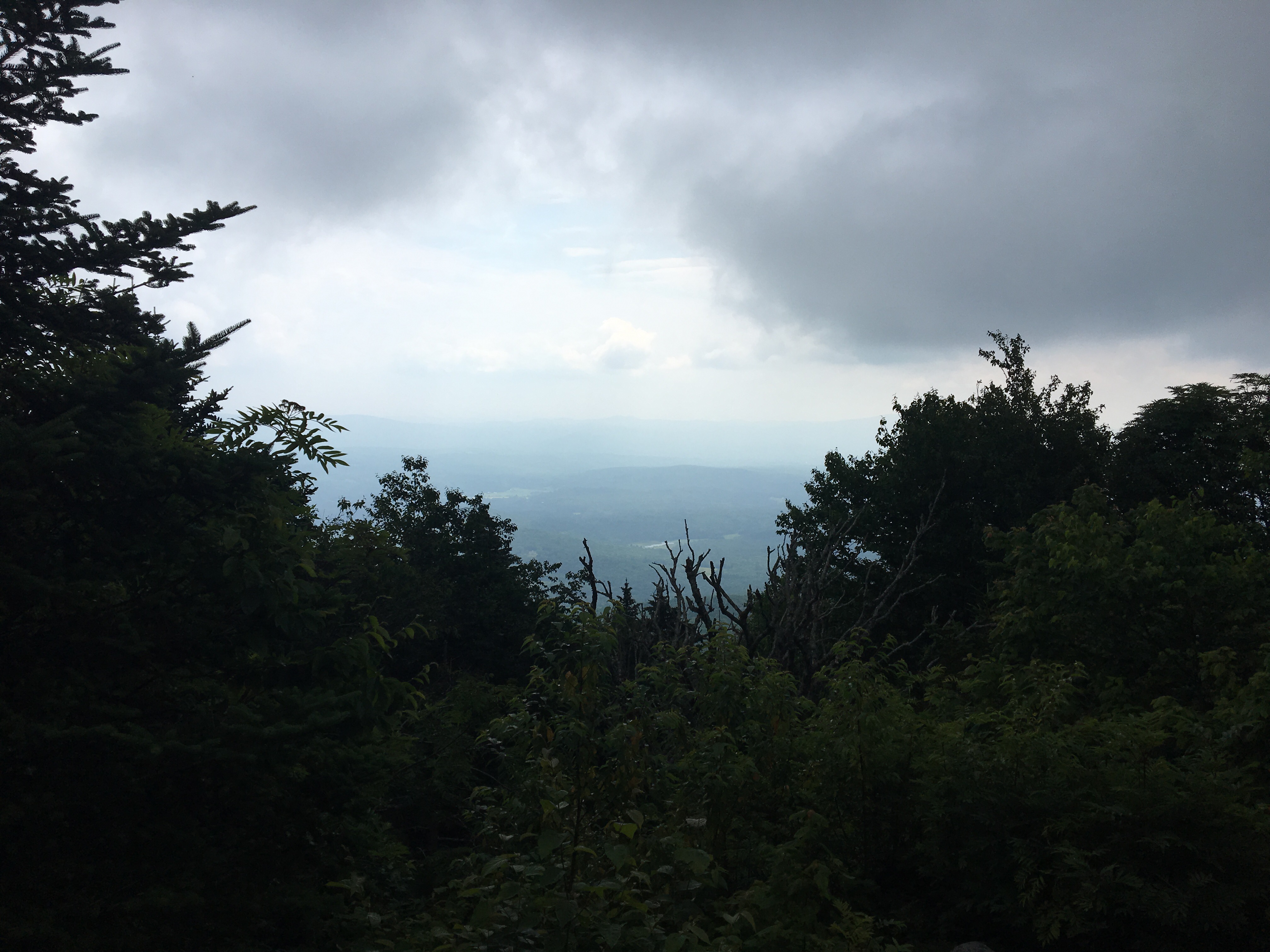
I also had no expectations for views today, which turned out to be realistic, for the most part. As the trail leveled outnearing the summit of Styles Peak, I remained in the “green tunnel”, and the trail continued to be made up of mud and the occasional boardwalk.

The summit had a “window” view from some rocky ledges. And due to the heat (the forecast was for temps in the 90s and high humidity), visibility was compromised.
The trail then dropped into the saddle between Styles and Peru Peaks. It was lovely and quiet. In fact, the quiet particularly impressed me. You may remember me commenting on how often one hears road noise on the trail, or train horns, rumbling Diesel engines and wheels clacking along the rails. I’m sure there have been many instances where I’ve experienced quiet on the trail, but I don’t remember being so impressed by it. There was a slight breeze, but no real sighing of wind in the trees. No sounds of water. Even the bird song was hushed.
There was also a fair amount of moose spoor along the trail; some seemed fresh, but, try as I might, I found no moose tracks in the mud nearby.
There was nothing calling out Peru Peak, so I only knew I’d been there after the fact, when the trail began a steep decline.
I reached Peru Shelter (4.6 miles in) right at noon. So I had begun to get back on schedule, but I was still concerned. I wasn’t ready to call Debbie to tell her to push back the pickup to 4:00, but had it in the back of my mind.
I ate lunch at the shelter, with a SOBO hiker and an older couple thru-hiking the Long Trail. The woman had thru-hiked the AT in 2013, with her husband supporting her. The SOBOer talked up a hostel in Rutland called the Yellow Deli run by a religious group called Twelve Tribes. I’ve heard stories about this hostel, which has three different locations on the AT, and am immensely curious about them, but it doesn’t fit my schedule to get there. Maybe I’ll get to the one in NH.
After chatting, I packed up my lunch bag, and collected some water from the nearby stream, then wished them all well, and continued up the trail.
I quickly reached Griffith Lake, where there is a tentsite looked after by a caretaker. All of the camping options along this stretch have a caretaker and an overnight fee, because it’s a heavily used section of the trail. It was quite pretty there, but, slack-packing as I was, I had no need for a campsite.


After Griffith Lake, I had expectations that the trail would remain level for a while before a long descent towards USFS 10. This was even knowing that the trail went near Baker Peak. The topographical map seemed to indicate only moderate elevation changes. Alas, not so. The trail began a fairly aggressive uphill turn, and then, just before the peak, there was a blue blaze bad weather bypass trail. Since the weather was nice, and especially since I wasn’t carrying my full pack, I started up the rocky ledges. I was climbing well, up until I neared the top, when I caught my toe on a stick hidden under a bush along the side of the trail. I managed to keep from falling, but my food bag went sailing over my head, landing a few feet in front of me. I took off my day pack to find that the weight of the water bottles had forced the zipper open, so the contents of pack were in danger of falling out at any time. I grabbed a rubber band and tied the two zipper pulls together, so I wouldn’t have that problem again.
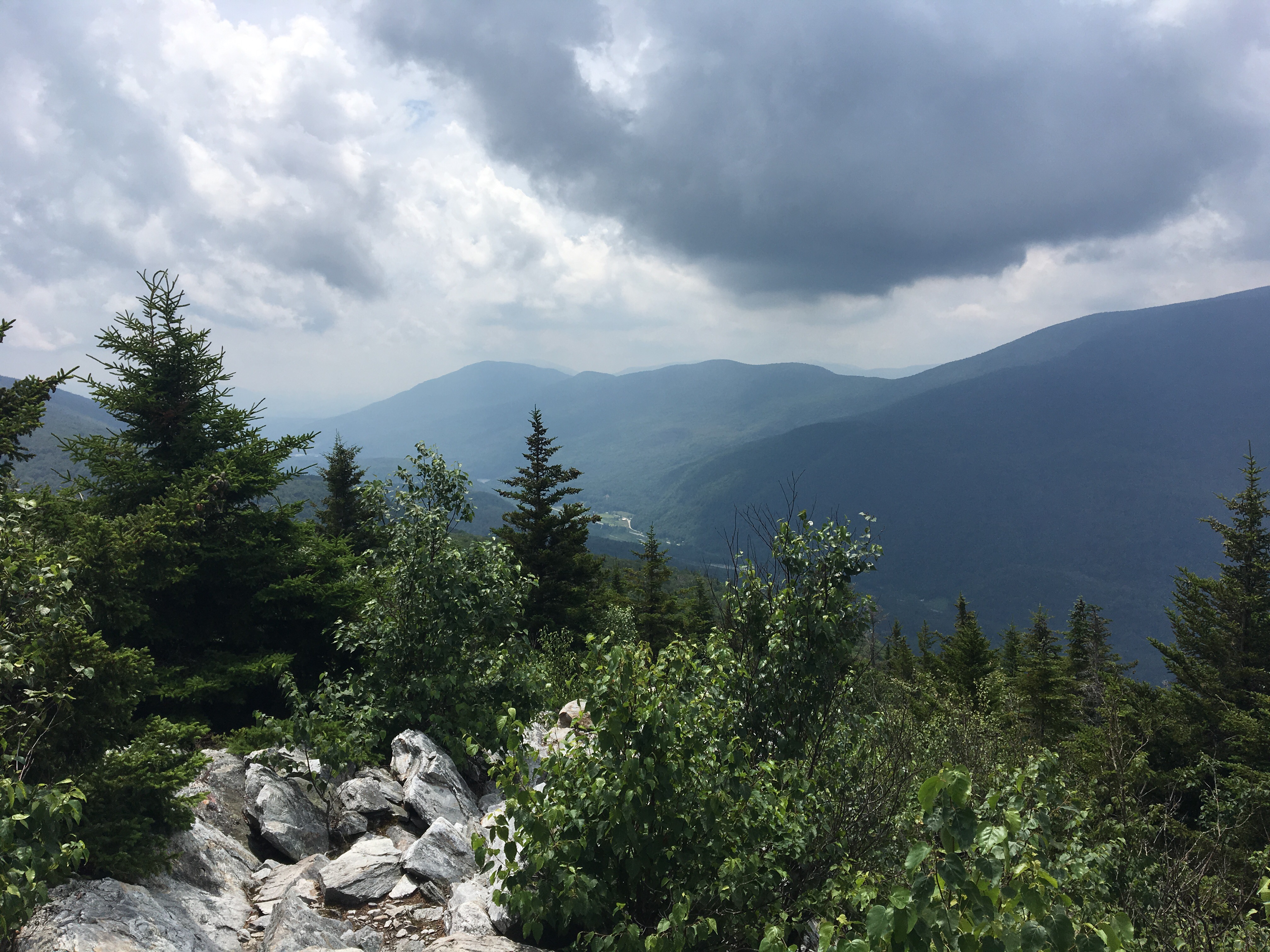
The view from Baker Peak turned out to be the best of the day, so I didn’t really mind the climb or the pack drama!

But the climb ate into my remaining time, so I was not completely happy. I would check my time when I reached my next milestone, the Lost Pond Shelter.
The trail began to do what I expected, from that point on. The descent from Baker Peak was moderate, and the trail mostly in good shape. It was 2:00 when I reached the shelter, which finally settled me down about meeting Debbie on time, since I had only 3 miles to go in 1 1/2 hours.
Those last miles went quickly, although I was beginning to get tired. At 1 mile out, I reached the suspension bridge over the Big Branch river, and the Big Branch Shelter. Then the trail started back up towards the road. I got to the trailhead around 3:10. Turns out Debbie struggled to navigate the roads with their missing or misleading signs, so she didn’t get to me until 4:00, just as I started to become concerned that something had happened to her.
It’s strange how quickly the cravings come back, because, back at the motel, I was in ecstasy over the soda that Debbie had poured for me, in a huge cup full of ice!!
So in the end, I’ve had two very successful days of slack-packing. Tomorrow, I get to see how well the shoulder holds out with a full pack!

Leave a comment