
Summary
June 24th
Mt Greylock summit to Sherman’s Brook Campsite
NOBO mile # 1593.8
Tolmann’s daily mileage 7.9
Tolmann’s total mileage 570.1
Two months on the trail!
The double beds at the Wagon Wheel motel in Lenox leave something to be desired, especially when sharing with someone else! Not an uninterrupted night’s sleep, for sure.
The plan for the day was breakfast, packing up, and dropping me back at the top of Greylock so I could continue my journey. I think Deb also hoped for a side trip to the barber for a haircut and trim of my beard! Not that I would have objected very strenuously. Alas, that just didn’t come together. People will still recognize me on sight as a thru-hiker.
Deb is concerned that I am losing too much weight. I don’t have a way to weigh myself most of the time, so it’s been a month or more since the last time, when I weighed in at 220. Anyway, she was fairly insistent that I stop and get a sandwich for lunch.
The moment of saying goodbye is such a painful one; it holds all my desire to be home with Debbie and family, and all my internal doubts about my ability to keep taking the next step. But there it was, that moment, and somehow I found it in me to turn toward the trail.
I had planned to hike Greylock last November as a gear shakedown, and got snowed out my first night. So, actually hiking the AT, I was interested to see how the reality matched my expectations. The main difference was that there is more extreme change in elevation; I had a flatter profile in mind.
The trail goes north from Greylock’s summit, dropping fairly radically into the saddle leading to Mt. Williams. That climb wasn’t too bad, and soon I was on William’s summit.  There were some day hikers there, and we spent a few minutes talking. I wasn’t exactly sure where the trail continued on, so asked. They said the trail switched back, so I looked where I expected a switch back would be, and off I went. Alarm bells started ringing right away, but I ignored them for a while. Only when I reached the base of the saddle and saw the signs there were my fears confirmed; I was heading southbound!!
So back I went again, passing my young friends. “Helps to go the right way!” I laughed.
The trail down William was pretty steep and longer than I expected. It crosses Notch Road about three miles from the summit of Greylock. Then it heads up Mt. Prospect, where it affords a lovely view west and north. 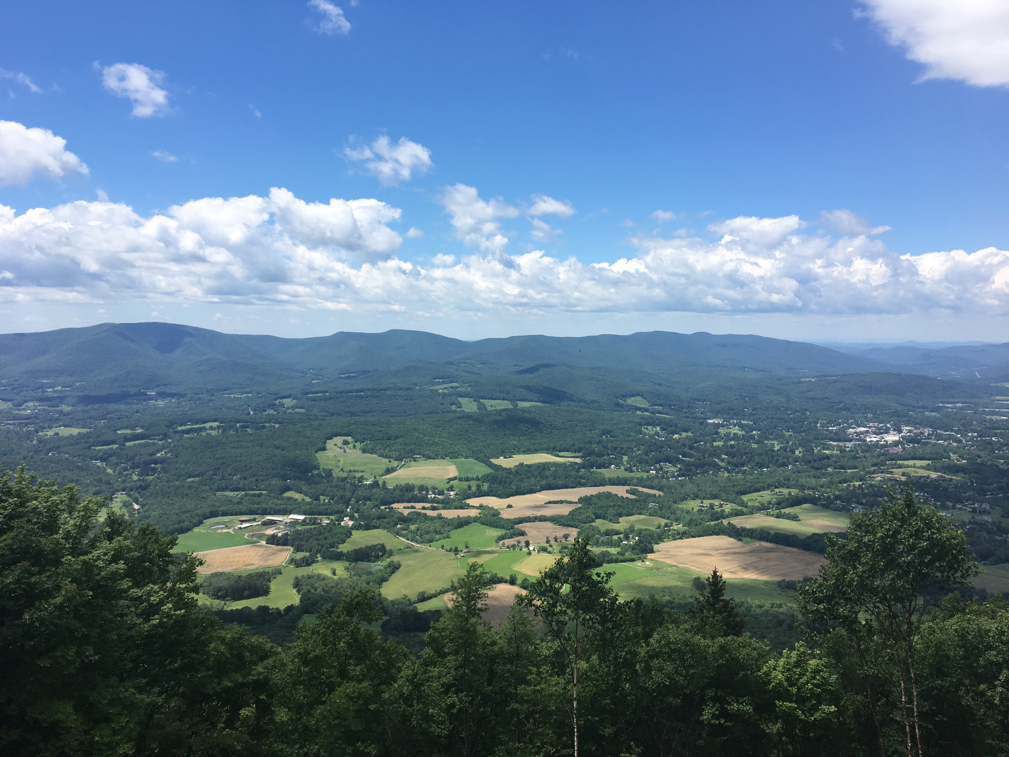

That’s where I sat and ate my sandwich. It was a little windy, but sunny and very pleasant. I met a local guy who was day hiking; he said that Mt. Prospect was his regular place to get exercise. Beats the gym by miles!!
So then it was down off of Prospect, which was a particularly steep descent, but I was feeling strong and fast. That is, until the mud started. I laughed, thinking “this is a presage of the Vermont mud.”
It slowed me a little bit, but I got to RT 2 around 3:30. Right before the road there was a sign on a tree advertising a local Papa John’s pizza as being hiker-friendly, which set me craving a soda. I checked Google Maps and it was .5 west on 2, which was within my craving tolerance.
As I got close, I saw that there was a Stop and Shop, which would give me a bathroom, plus many more options for drinks (like my latest favorite: chocolate milk)!
So Papa John’s lost my business to Stop and Shop, and there I was, sitting out front with a Friendly’s sundae cup and a quart of chocolate milk. When I looked at my watch, it was 4:30-ish, and I still had some miles to get to my campsite for the night.
So back the .5 miles to the trailhead, and back into the off-again-on-again mud. But I was fortified with chocolate milk and ice cream, so even the mostly uphill climb wasn’t really a problem.
The campsite had one other person in it, so there was no problem picking out a site for my tent. 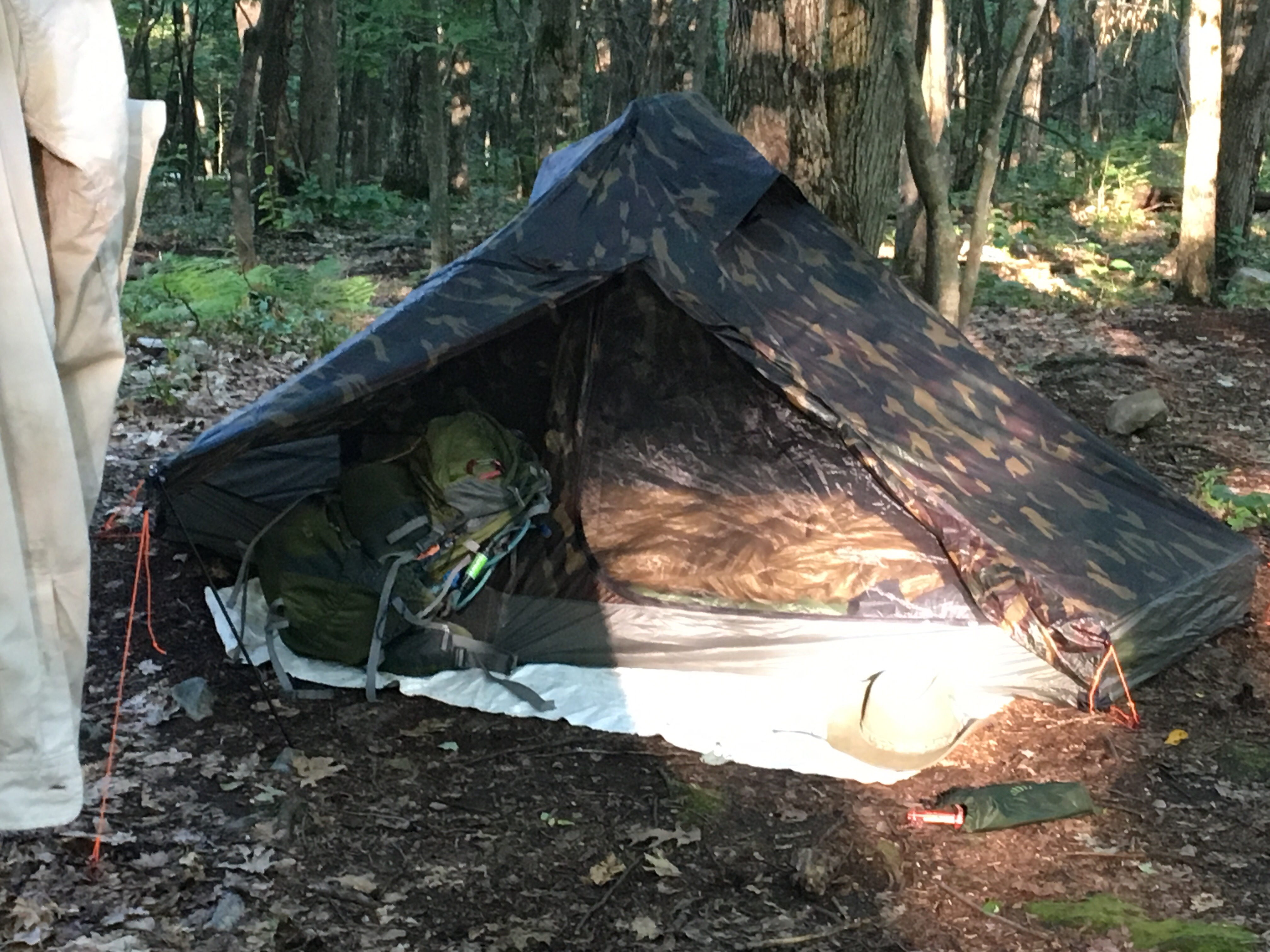 I could have eaten a more nutritious, calorie-rich dinner, but had short-circuited my appetite with choco-milk and ice cream. <sigh> (my drinking problem strikes again!)
And so my last day in Massachusetts draws to a close.

Leave a comment